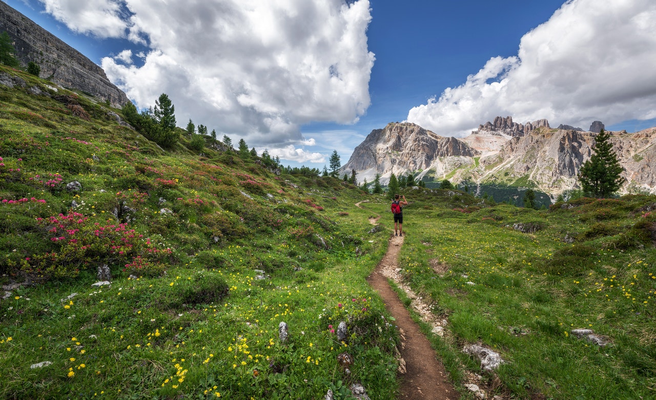
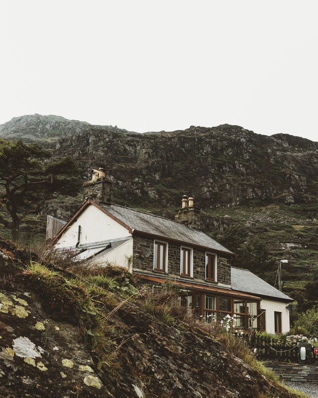
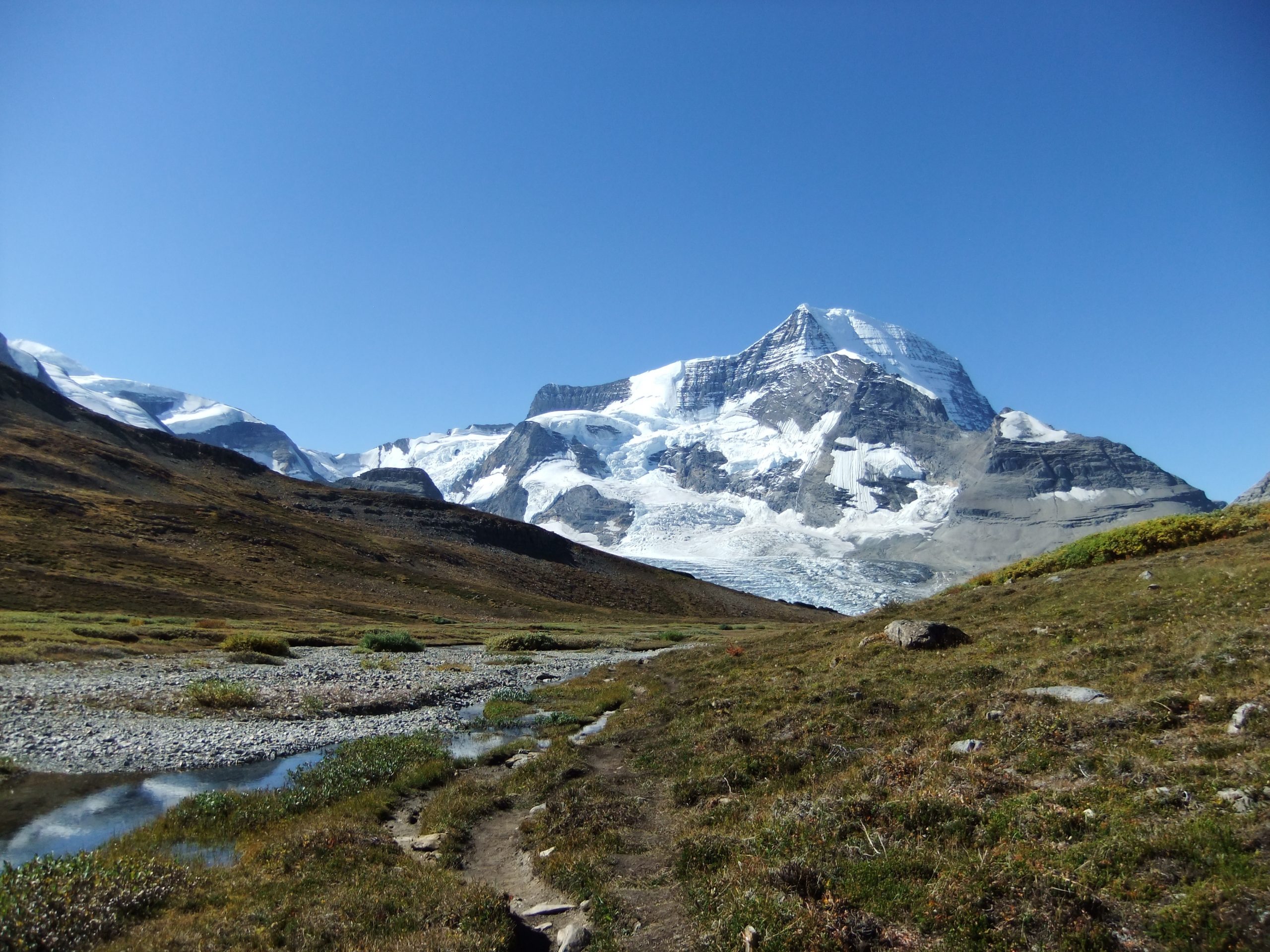
The Via Dinarica is on its way to becoming one of the world’s top trekking destinations.
Traveling along the Via Dinarica Hiking Trail, you’ll get to explore some of the most magnificent and highest peaks of the Dinaric Alps. You’ll also get to hike along lush valleys, pristine beaches, and cultural monuments.
The name Via Dinarica refers to the route linking Bosnia & Herzegovina and Montenegro with Albania using the most spectacular parts of the Dinaric Alps.
It’s long, arduous and tiresome, but trust us – it’s worth it!
If you’re planning on exploring the countries before you venture out on this epic trail, check our guides out:
 Countries it passes through
The Via Dinarica is the first and only long-distance hiking trail to traverse the heart of the Dinaric Alps. The trail follows a 1,200-mile route from Slovenia’s Adriatic coast northeast along the spine of these mountains, via Croatia, Bosnia and Herzegovina, Montenegro, Serbia, Albania, and going along the borders of Kosovo and Macedonia.
Along its length, the paths of the Via Dinarica cross a rich cultural and natural landscape that reflects two millennia of history.
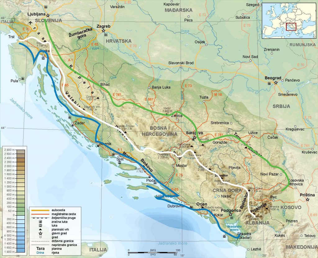
Via Dinarica Trails
Below you’ll find all the main trails along the Via Dinarica Route. This info was taken from the official site trail.viadinarica.com and is updated regularly. For the most up to date info, check the official site.
White Trail
The Via Dinarica White Trail (Via Alpina) is a 4,500+ km long trail stretching from Slovenia to Montenegro, connecting six countries.
The White Trail has been constructed to showcase the beauty of an entire mountain range and provide those who partake in its activities with a unique experience.
The trail stretches 1,000 kilometers across many countries, connecting almost all of the highest peaks in the Dinaric Alps.
Slovenia: From Via Alpina to Via Dinarica
Trails? Slovenia’s Via Dinarica White Trail, the Via Alpina, and other hiking trails are combined in this route.
From the border with Italy to Predjama, the route follows the Via Alpina red trail. From there on, it’s a combination of the newly Via Dinarica White trail and the Slovenski Planinarski Put to Gorenje.
Finally, the Slovenia 100 Mile trail continues to Sveti Lovrenc, Planina, and Rakov Škocjan. In Rakov Škocjan, there is a trail that leads you along the river Rak. Through the forest, you’ll see the magical Cerkniško lake.
During the summer, the lake might disappear completely. From Cerknica, there is a well-marked hiking path up to mount Slivnica, the home of the witches. The next mountain (hill) is Križna Gora, next to Križna Jama, a beautiful cave. This part of the route is part of the Cerknica Transversale.
Croatia: Via Dinarica Tršće – Sveta gora – izvor Kupe – Crni Lug
Through the region from Tršće National Park to Risnjak National Park, hiking trails on Via Dinarica follow the Gorski Kotar Hiking Trail.
Tršće is the starting point for a road climb to Kraljev Vrh. After that, you’ll continue hiking by following the marked hiking trails southward and towards the hill of Sveta Gora.
As you descend toward the Kupa River canyon, the route takes you steeply through the forest away from Sveta Gora. Hiking trails lead straight to the source of the Kupa River from this area. Kupa’s source is beautiful since it springs from a clear lake and flows instantly like a large river.
Croatia: Via Dinarica HR-W-12 From Alan to central Velebit
The broader area of Alan features several grasslands and meadows with picturesque peaks rising above, mainly oriented to the coastal side of Velebit.
Alan is also famous due to the Alan mountain hut located along the Velebit Hiking Trail and the Premužić Trail. The sea view from this area, with the islands of Rab and Pag visible, is one of Velebit’s most impressive sights.
Šatorina and its high mountain surroundings make up the central part of Velebit. In addition, there is an area of abandoned karst fields under Atorina and a somewhat lower area of Matijević Brijeg. They served as an essential source of livelihood for the locals until the mid-20th century.
Finally, a short distance from the mountain’s summit, below Aorina, we discover the valley of Štirovača. Due to its virgin forests, this valley cuts deep into the terrain.
The community of Kupna kuća on the road that links Štirovača and Dabri is an excellent place for hikers from Alan to Ravni Dabar to find mountain shelters. In addition, Velebit’s central peaks can be reached from these facilities.
Bosnia and Herzegovina: Via Dinarica BH-W-05 Čvrsnica mountain
Cvrsnica Mountain, the highest Herzegovian mountain, is a great hike that stretches from the Plaza plateau, then descending nto Jablanica city along Vilinac and Trinjaca ridges.
Bosnia and Herzegovina’s Cvrsnica Mountain is one of its most famous peaks and is one of the highlights of the Via Dinarica. There are a few small lakes near the destination and a rock eye called Hajducka Vrata (Rebel’s Gate), the highest mountain lodge of Via Dinarica.
As well as the Vran mountain, the tour offers terrific views of the Plocno summit, Pesti Brda, and Diva Gragovica valleys. For the most part, the trail travels through a pristine mountain wilderness, beginning in an endemic munika pine forest and ending in alpine scrub habitats.
Bosnia and Herzegovina: Via Dinarica BH-W-11 via Lelija and Zelengora Mountain to Sutjeska National Park
There are three summits and five lakes along this great mountain hike that crosses Lelija and Zelengora.
In Osllji, the trail turns towards Lelija Mountain after following the forest road towards Cemerno and Orlovacko lake. The trail continues after the forest road ends, passes Jablan spring, and passes below Velika (Great) Lelija (2032m). A 15-minute climb will get you to the summit quickly.
As the trail continues south, it passes through really remote and wild terrain. By continuing south over more challenging terrain, the path will reach a long mountain meadow. Finally, a trail leads to Stirine and Stirinsko lake, remnants of an old shepherd settlement.
Montenegro: Via Dinarica BH/CG-W-01 Maglić to Pivska mountain via Piva Canyon
Mountain transversal trail Durmitor – Maglić, access for mountain-climbing routes Bioča, Maglića, Trzivka, Trnovičkog Durmitor, challenging, exhausting, demanding – endurance, good orientation, and good skills moving through the rocks and reefs.
New markings and signals, winter marking, don’t exist, a local guide is recommended, required for larger groups of hikers.
Montenegro: Mountains of Montenegro – Žabljak via Sinjavina to Biogradska Gora
An introduction to the majestic experience of the massif of Durmitor and its wild beauty and strength continues as we explore the attractions of Durmitor National Park.
The hikers who visit Zminicko and Black Lakes have the opportunity to enjoy the hospitality of local households.
There are also distant houses in this area, and households that live in this region year-round are real rarities.
Sinjajevina mountain offers expansive views of the forest in this area.
In this direction, one reaches the most stunning lake in Durmitor National Park, Zavojsko Lake, on the Sinjajevina mountain that has little water.
Green Trail
The Via Dinarica Green Trail is the new European Cultural Route crossing seven countries and offering unique landscapes and cultures. The trail stretches for 6,000 km across the Dinarides from Slovenia to Albania.
The route passes untouched forests, Balkan mountains, and mighty rivers. It is a very untamed wilderness and has fascinating people and cultures—a truly fantastic experience for anyone.
Unfortunately, the Dinaric Green Trail is not finished. But if you are ready for adventure, it’s the right choice for you! For years the Via Dinarica project has been active in assembling trails through the most inspiring mountain range in Europe, the Dinarides.
By now, a large part of this trail network is complete and ready to be used. So, future hikers will have access to a wild and scenic hiking experience along ancient trails, evolving to international standards.
Croatia: Via Dinarica HR-G-01 The area of Skrad
Brod Na Kupi is the border crossing point from Slovenia into Croatia on the Green Line of the Via Dinarica. The tour begins with a visit to our country’s most scenic canyon – Vražji Prolaz (“Devil’s Passage”) – and then we ascend to Skrad.
Skrad has been the center of tourism and mountaineering in Gorski Kotar since ancient times. Among the settlements in Gorski Kotar, this settlement is the most closely tied to the mountains. A steep slope slopes down from this settlement to the Skradski Point, on the main road and rail link between Zagreb and Rijeka.
Vražji Prolaz nestles at the bottom of a natural depression in Gorski Kotar, opposite Skradski Vrh, beneath Skrad – an example of a beautiful natural phenomenon. One of its most attractive features is the narrow canyon of Jasle Creek. The creek of Curak cascades into the magnificent cave portal of Zeleni Vir (“Green Whirlpool”), not far from Devil’s Passage.
The ambiance is enhanced by roaring watercourses and pleasant forest shades. Geomorphological reserves protect the area around Zeleni Vir and Vražji Prolaz, which are located below Skrad.
Croatia: Via Dinarica HR-G-02 From Skrad to Javorova Kosa
On the way to Ravna Gora from Skrad and Skradski Vrh, we encounter a mountain slope approximately 5 kilometers long, which spreads in the same direction as the Dinarides, with the village of Javorova Kosa at its southern end. Through a longitudinal trail that crosses both Kicljeve Jame and Kicljev Vrh, Skradski Vrh can be reached from Ravna Gora.
The Gorski Kotar Hiking Trail (Goranski mountain way) connects Skrad and Skradski Vrh (1 hour and 30 minutes). Skrad’s markings first lead us through the settlement, next to the cemetery and church, then ascend across a small meadow into the forest.
A viewpoint (Kvranov Rock) is reached 20 minutes after the start of the trail. A small chapel and a glade appear on top after we cross an asphalt road and after a steep and long climb along a forest road.
Croatia: Via Dinarica HR-G-04 From Kamačnik to Klek
There is a canyon running through the northern slopes of the forested massif of Velika Kapela. It faces north and is cut into the terrain by a small river called Kamačnik. The area south of the canyon is dominated by uninhabited mountainous terrain – a continuation of the mountain of Klek above Ogulin. Bijela Kosa is one of the highest peaks in this massif.
The canyon of Kamačnik, whose waters flow from a small dark green lake surrounded by steep slopes, is of particular interest to hikers.
Within Vrbovsko’s center are trail markers leading hikers on a tour of Kamačnik and along the path to Klek. Vrbovsko railway station is reached after descending briefly on the route. Then we cross the railway track (due to poor visibility!) and soon reach a fishing hut (in fact, a restaurant) at the confluence of the rivers Kamačnik and Dobra (10 minutes away from the railway station). A tourist path starts here through Kamačnik Canyon. Throughout the canyon, the route takes us along the edge of the rock, through wooden galleries, and over bridges. At its narrowest part, two viaducts of the Zagreb – Rijeka Motorway pass above the canyon.
In a few minutes, the canyon opens up into a valley, and visitors choose between two paths: one leads to Klek (6 hours of hiking), one leads to the left bank of Kamačnik with 15 minutes left to hike to the source of the small river.
Croatia: Via Dinarica HR-G-07 Plitvice Lakes National Park
Plitvice Lakes are among Croatia’s best-known and most beautiful symbols, despite the uniqueness and picturesque nature of Croatia’s long coastline, attractive mountains, and indisputable beauty of many lowlands.
There is no doubt that Plitvice Lakes is one of the most beautiful national parks in Southeast Europe. With its incredible natural beauty. The lakes form a terraced series of lakes, where water cascades from one to the next and cascades across small and large cascades.
There are 191 hectares of surface area in the lakes and 19,200 hectares in the entire national park. Plitvice’s most gorgeous cascade is the cascade of Sastavci, which has a height of 40 meters. Lake Pljesevica, the highest point, is 1280 meters above sea level, and lake Mala Kapela is 417 meters above sea level.
The Plitvice lake series consists of 16 large lakes and several small ones, each with over 40 cascades. There are hotels, inns, and various catering facilities along the state road that runs through the area, along the edge of the national park. For parking access, you must purchase an entry ticket.
Croatia: Via Dinarica HR-G-08 Eastern Lika
There is no suitable tourism and excursion infrastructure in the far eastern part of the region of Lika that would allow classical hiking along the Via Dinarica Green Line, except for a small area immediately around Plitvice Lakes.
It is anticipated that a section of the E-6 European Long-Distance Path will be formed in this area from Ogulin to the border crossing point Ličko Petrovo Selo once this route is developed. In the meantime, hikers can use the old hiking trail across Ostri Medvjecak and two bypass road routes connecting Plitvice Lakes and Ličko Petrovo Selo. Licko Petrovo Selo is where the road ends in Croatia, and just a short drive later, Via Dinarica continues its journey in Bosnia and Herzegovina.
Bosnia and Herzegovina: Via Dinarica Green Trail
This new version of the Via Dinarica Green Trail is in Bosnia and Herzegovina. A lot of cultural and natural sites are connected by the Via Dinarica Green Trail, which hopefully will be developed in the near future.
We aimed to link hiking trails, trail runs, National Parks, exciting sights, natural and cultural highlights in Bosnia and Herzegovina. There are some parts of our hike that can be completed by bike as well.
When we hiked it, there wasn’t much information available. The route was created along the way, trying to find the most hike-able route, but some asphalt, macadam, dirt, and forest road sections.
It seems that there are many options to hike, which means we could hike another month, two months, or even three months exploring.
Serbia: Rasno – Tutin (Via Dinarica Green Trail)
The Via Dinarica Rasno – Tutin or the Green Trail is a hiking trail in Serbia worth hiking. It is 22km long and located within the region of Tutin in Serbia.
The Via Dinarica Rasno – Tutin or the Green Trail is at an altitude of 130m. It starts from Rasno (at an altitude of 115m) and ends at Tutin (at an altitude of 165m). The most interesting part, things, events, activities, sightseeing locations on the trail are: Stone house, Old anchorage pit, Mouth of the Lim stream (on the right bank), One part of meadow near stable (on the right bank), Baroque church, Vinarci stone
Serbia: Tutin – Orroberd (Via Dinarica Green Trail)
The Via Dinarica Tutin – Orroberd (Via Dinarica Green Trail) in Serbia is a 15.3-kilometer hiking trail near Tutin, Serbia
Kosovo: Orroberd – Source of the White Drin, Radavac (Via Dinarica Green Trail) Extension in Kosovo
The Orroberd is a multi-day high route in Kosovo, 120km long, and takes six days to hike.
This route was awarded the WTA designation “Via Dinarica Extension” because of its unique beauty, geological diversity, and cultural heritage. The southern part is a topo trail, qualifying it for hiking with just a map and compass (SI), while the northern part takes you through steep canyons and ancient woodlands.
Macedonia: Via Dinarica Extension
Orienting from Ljuboten through Crvena Voda (Ohrid) on the West Macedonian Transversal.
It traverses the mountains of western North Macedonia on a hiking trail known as the Macedonian Transversal. The trail leads from the mountain hut Ljuboten (or Staro Selo) to Crvena Voda or Ohrid if you don’t mind walking on the road at the end.
Others view the Macedonian Transversal as a continuation of the Via Dinarica, but the route has its own history. In 1975, a group of Macedonian mountaineers named the trail the “First Macedonian Traverse” or “Prva Makedonska Transverzala.”
Blue Trail
The Via Dinarica Blue Trail is rarely walked. As a result of the extremely hot and dry summers, especially on the coast, it’s best to hike the Blue Trail in autumn or spring. Having a beautiful coastline also means avoiding the massive tourism that unfortunately comes along with it.
Almost 1,900 miles of breathtaking landscapes surround the Via Dinarica Blue Trail, which crosses four countries in Europe. The name was inspired by the Adriatic sea, otherwise known in Croatia as the Dinaric sea, and its mountains.
This trail is very rarely used since it should be walked from west to east, not vice versa.
It allows for day hikes as well as overnight walks along with the coastal areas of Croatia’s Istria peninsula up to Slovenia and past Mount Triglav.
Via Dinarica HR-B-01 Savudrija – Buzet: Istrian Hiking Trail and E-12 trail
From Slovenia, the Via Dinarica Blue Line enters Croatia from the mountain of Cicarija along a trail called Sakomanov Path and the border crossing point Rakitovec / Slum (for citizens of EU member states).
Foreign visitors who are not citizens of EU member states can cross the border at Požane / Sočerga near Buzet.
Via Dinarica HR-B-03 Učka Nature Park
Učka is shaped like a triangle, with steep sides and sharp ridges. The highest point is located at the beginning (Vojak, 1396 m.a.s.l.). Afterward, the ridge gradually descends with the peaks of Brgud (906 m), Šikovac (780 m), and Sisol (883 m) before disappearing into the sea at Plomin bay.
The terrain is steeper toward the west of Učka, the landscape is steeper, descending steeply to Vranjska Draga, Boljunsko polje, and Čepićko polje. A typical karst mountain, Učka features many pits, caves, and sinkholes but is also rich in springs and lush forests. Učka became a nature park in 1999 because of its abundance and diversity of plants.
HR-B-06 Island of Krk
Croatia’s coast is known for its numerous islands. Several islands, reefs, and islets dot the Croatian Adriatic archipelago. They occupy an area of about 3,300 square kilometers or 5 percent of Croatia’s total area.
Adriatic’s largest island is Krk, located between Cres and Krk. A karst island situated in the Kvarner Bay, between the regional coastlines of Croatia and the Istrian peninsula, occupies a central spot in the bay. The island’s northern part is a plateau roughly 60 meters above sea level, with degraded vegetation and mainly bare terrain due to its limestone surface and strong bora winds.
The central and southern parts of the island are generally more vegetated and more interesting. A unique feature of the southern part of the island is the closure of the Bašćansko polje by two mountain ranges. In the southwest corner of the field rises Obzova, the highest peak of the island. Below Diviška, on the northeastern ridge, is Target, the narrowest ravine in Croatia.
Given the green color of their vegetation, the fields in between provide a stark contrast. In Bašćanska Draga and Jurandvor (where the cultural landmark Bašćanska ploća – the Baška Tablet can be found), the vegetation is unusually lush.
Via Dinarica HR-B-09 Paklenica National Park
The area of Paklenica is one of the fascinating karst areas in Velebit and Croatia. As a result of torrential flows at the base of the highest peaks of Velebit, two deep canyons have been created, which represent a combination of longitudinal and deeply cut valleys from a geomorphological standpoint.
Velika Paklenica and Mala Paklenica are the most interesting sections, where creeks have carved out their beds through the rocks, some over 300 meters in height. Paklenica was declared a national park for its exceptional natural values. In Europe, Paklenica is known as one of the most beautiful rock climbing sites due to its pleasant climate, beautiful landscape, and diverse climbing opportunities.
Via Dinarica HR-B-12 Vransko Jezero Nature Park
A curious traveler who is exploring northern Dalmatia on a trip between two cities rich in history – Šibenik and Zadar – will undoubtedly be attracted by an intriguing natural phenomenon along the way.
The low Adriatic coast will draw the traveler’s attention, and on the other side, just a few hundred meters away from the coast – by a large natural lake with typical wetland characteristics. There are few sites as small as this one, where one can experience three totally different landscapes: sea coast with a rich archipelago in front; Mediterranean wetland with a unique landscape and a rare wetland ecosystem; finally, the idyllic rural setting of the settlements of Ravni Kotori right behind the hill.
Via Dinarica HR-B-15 Kozjak
The Kozjak mountain has two completely different faces. It resembles a mighty rocky barrier towering above the bay of Kaštelanski Zaljev from the coastal side.
It takes the shape of an undulating plateau located on the mainland, which ends in a sharp ridge. We come across the mountain’s highest peaks on the very edge of the plateau, on average 600 to 700 meters above sea level.
Located 16 kilometers from Malačka Pass to Markezina Greda at Klis, the series of peaks begins. Dinarica’s path parallels the line of Kozjak as it continues from Malačka to Klis, then upon reaching Mosor, it continues on to the mountain of Mosor.
There is a partial overlap between Via Dinarica on Kozjak and the Cradle of Croatian Statehood and the Soline Hiking Trail on Kozjak. On the Via Dinarica route, you will also see the old hill fort of Klis, one of the most picturesque historical fortresses in Croatia.
Via Dinarica HR-B-18 Biokovo Nature Park
There are no other places where the gigantic mountain range of the Dinarides has approached the sea so closely or created an image as exciting and impressive as the Makarska Riviera.
In this part of the Adriatic coast, the impressive wall of Biokovo dominates with its talus deposits, cracks, and towers and forms an important part of the Riviera postcards.
Makarska Riviera is a coastal belt in central Dalmatia, between the cove of Vruja to the northwest and the Cape Višnjica at Ploče to the southeast. The mountains of Biokovo and Rilić separate this area from the hinterland, which is approximately 60 kilometers long and 3 kilometers wide.
However, even though it is lower and quite separated from the central part of Biokovo, the mountain of Rilić can be considered part of Biokovo’s southeastern area. In recognition of its unique shape, significance, and natural wealth, the entire mountain of Biokovo is protected as a nature park.
 Via Dinarica Mountain Huts
Slovenia – Koča Mladika na Pečni rebri Mountain Hut, 726 m
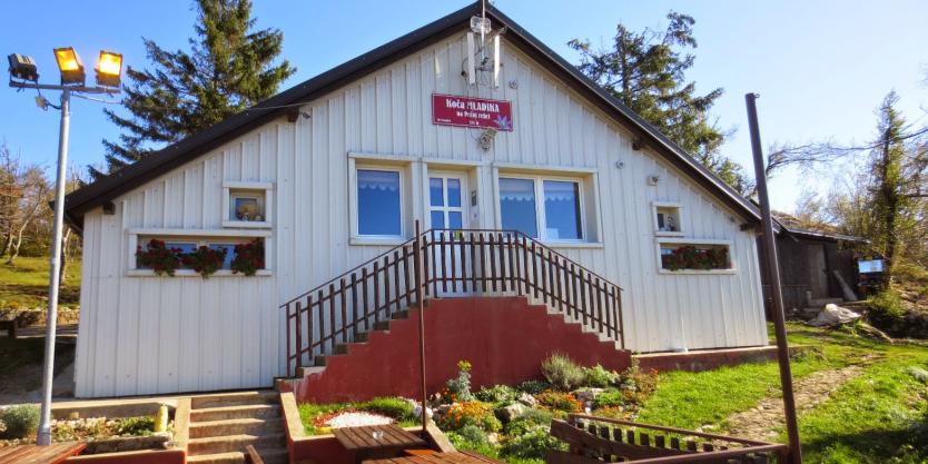
A beautiful view of the Postojna Basin (Postojnska Kotlina) with Postojna and the mountains surrounding it can be seen from the hut Koča Mladika.
From the east, we can see the extensive slopes of Javorniki, and to their right, the ridge that extends into the Pivka valley with Savič, Sv. Trojica (the Holy Trinity) and Veliki Vrh are on top, and behind them rises Snežnik.
A few hundred meters south of the Postojna Basin, the woody peaks of Ravnik and Vremščica rise and Brkini and Slavnik.
The high ridge of Nanos, including Pleša and Suhivrh, rises above the Postojna Basin.
There is a wooded area to the northwest of Idrijski Javornik, flanked by Sv Lovrenc, a grassy peak with a snowy peak to its south.
The hut is located on the south slope of Pecna Reber (763 m), a little above the peak. Including the bar counter, there are 32 seats in the restaurant area. Twenty seats are available on the terrace in front of the hut; there is no accommodation and the restaurant is heated by a stove.
Croatia – Mountain lodge Schlosserov dom, 1,428 m
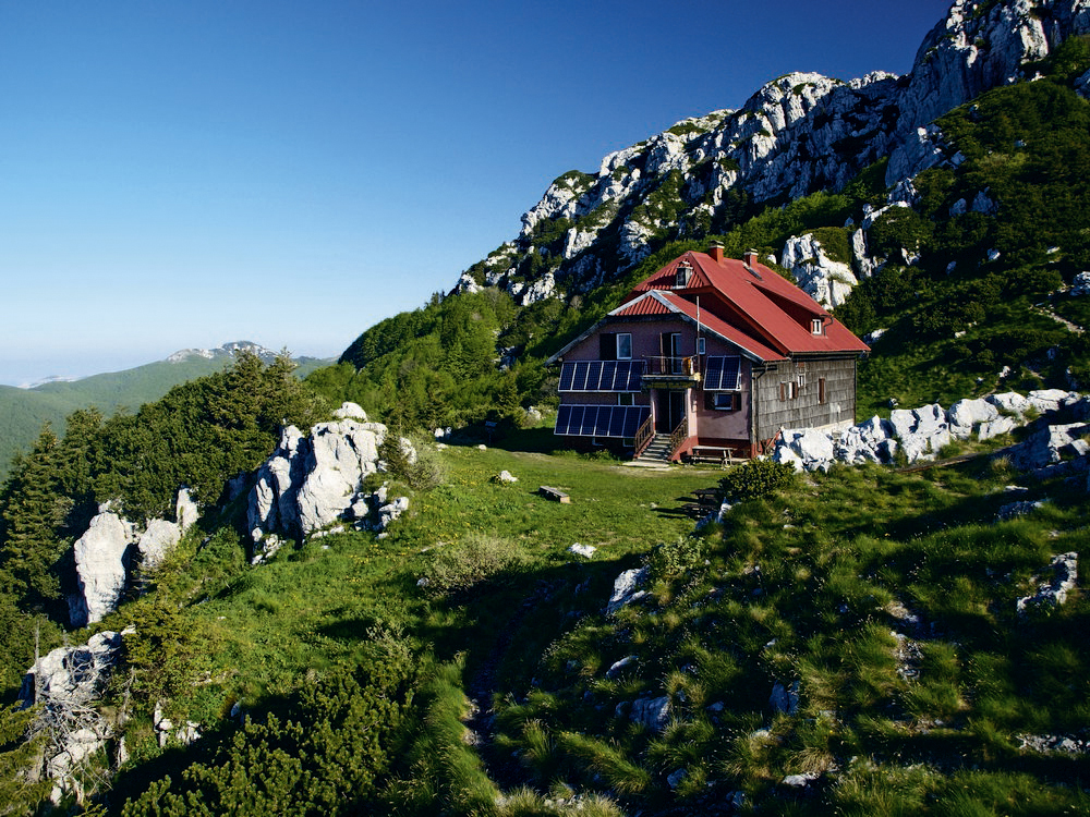
On Schlosserova Livada, a meadow between the summits of Veliki Risnjak and Mali Risnjak lies the mountain lodge Schlosserov dom.
The facility bears his name in honor of Dr. Josip Schlosser Klekovski, the founder of Croatian botany and the first president of the Croatian Mountaineering Society (HPD).
On the ground floor, you’ll find a large dining room, a winter room, a kitchen, and the residence of the person in charge. In the attic, there is a shared dormitory, and there are rooms with beds upstairs.
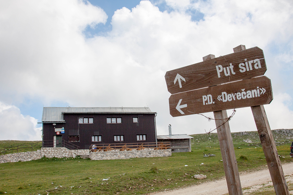
Bosnia and Herzegovina – Mountain Lodge Jusuf Pecenkovic, Devecani, 1,763 m
The lodge is located on the Devečani plateau at 1763m above sea level, above Devečanske Stijene rock formations on Vlašić Mountain.
The lodge was built in 1935 and is operated by Mountain Club “Vlašić.”
The lodge can accommodate 45 people in a few dormitories. Guests are provided with two comfortable lounge rooms. A nearby pump station provides drinking water, and the public distribution grid supplies the building’s energy.
Bosnia and Herzegovina – Mountain Lodge “Gostilja”, 737 m (Close to Serbian border)
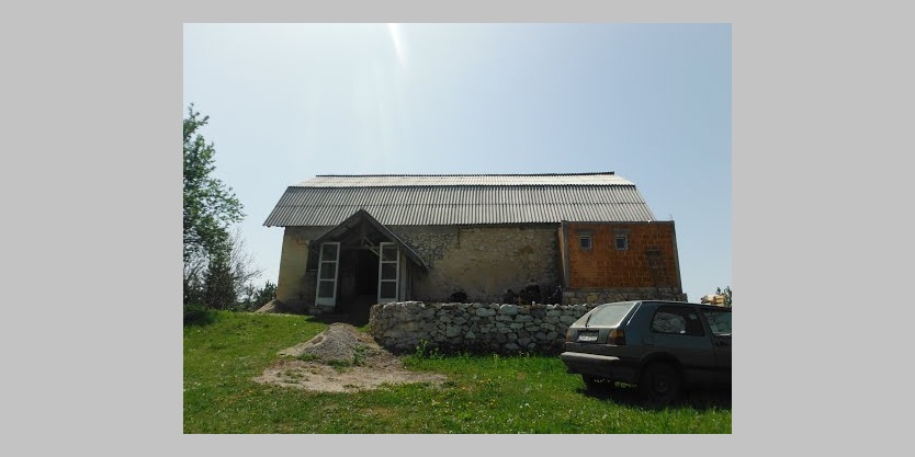
Before, the lodge was a hunting hut, but during the last war, it was used by military forces, which left it in very poor condition.
Currently, it is maintained by the local Mountain Club Stolac from Višegrad.
The Mountain Lodge Gostilja is about 2.5km from the Serbian border and around 10km from Visegrad. The village is located in Gostilja.
There is one room with four beds and another with five beds at the lodge. There is also a dormitory with 11 additional beds. Unfortunately, the lodge is generally not in the best shape, and there is no electricity.
Montenegro – Mountain hut Džambas, 1,415 m
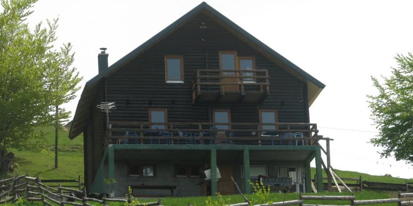
The mountain hut Džambas was built by volunteers of the hiking and sports organization “Dušan Bulatović – Džambas.”
The hut quickly became popular with local and foreign mountaineers alike and can accommodate up to forty people. The landlord will also provide food and drinks upon request.
Another hut with fewer beds is located quite near this one towards the south along a marked trail from Mojkovac to Pržište to Marinkovac and to Žarski Katun.
As part of the hiking and sports organization Brskovo of Mojkovac, the hut was built by volunteer members.
Albania – Quku i Valbones : Rilindja Alpine Rooms, 747 m
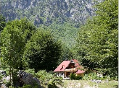
Rilindja (“Rebirth”) is the oldest restaurant in Valbona, having opened in 2005. It is a cozy place! Four small twin rooms with one shared bathroom are located upstairs.
Two of the rooms have large balconies. Small, cozy, and very basic, these rooms are best for those who intend to be out and about most of the time.
Among the menu items are whole goats grilled on a grill, traditionally served at the restaurant.
At the Information Center, you can always find the most up-to-date information.
 General Tips
The trail includes GPS tracks of water sources, accommodation, and other amenities. However, you are strongly encouraged to read about the trail and the region and see the map before you leave.
Make sure you use a GPS, practice navigating, and check trail.viadinarica’s comments and conditions. This is a community for hikers on the Via Dinarica.
When To Do It
Hiking season starts in late May or early June (depending on snow) and is extended until October.
There are many trails exposed in the summer, which means there’s a lot of wind and sun. It’s a very, very dry landscape, and that’s characteristic of the karst mountains.
It does not rain much, and when it does, the water disappears immediately.
The mighty wind called Bura is known to occur in Velebit. Weather can change very quickly in Velebit, as well as many other mountains.
Visiting between June and September is ideal, but be sure to bring sunscreen, good walking shoes, a light rain jacket, and a packable down jacket.
Accommodations
Accommodation on the trail is an essential factor; it impacts your trip in a way that missing one day is usually made up for with another.
Camping or staying in mountain huts are the cheapest accommodation options. They can be great for the budget traveler.
Accommodation during the Via Dinarica Route should be mostly arranged in advance so that you can safely focus on the journey. You will only need to bring basic camping gear, such as a sleeping bag and a mat.
 Sights to see
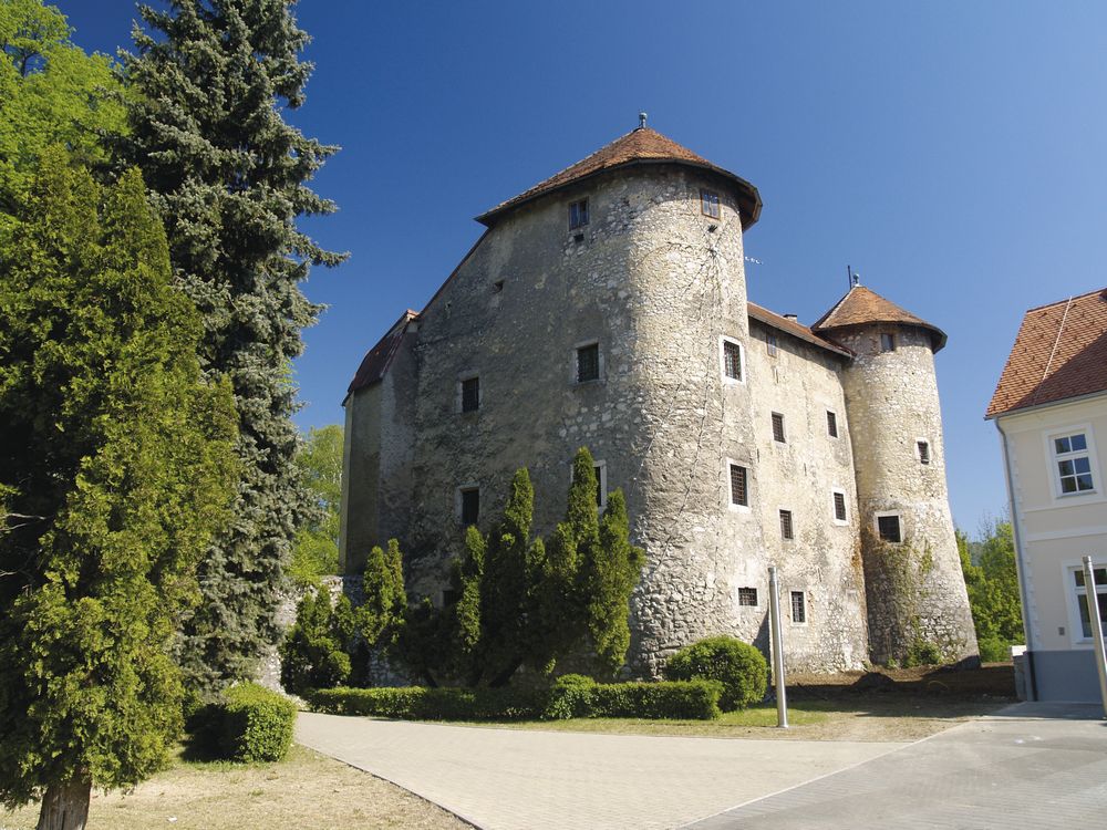
Predjama Castle – Slovenia
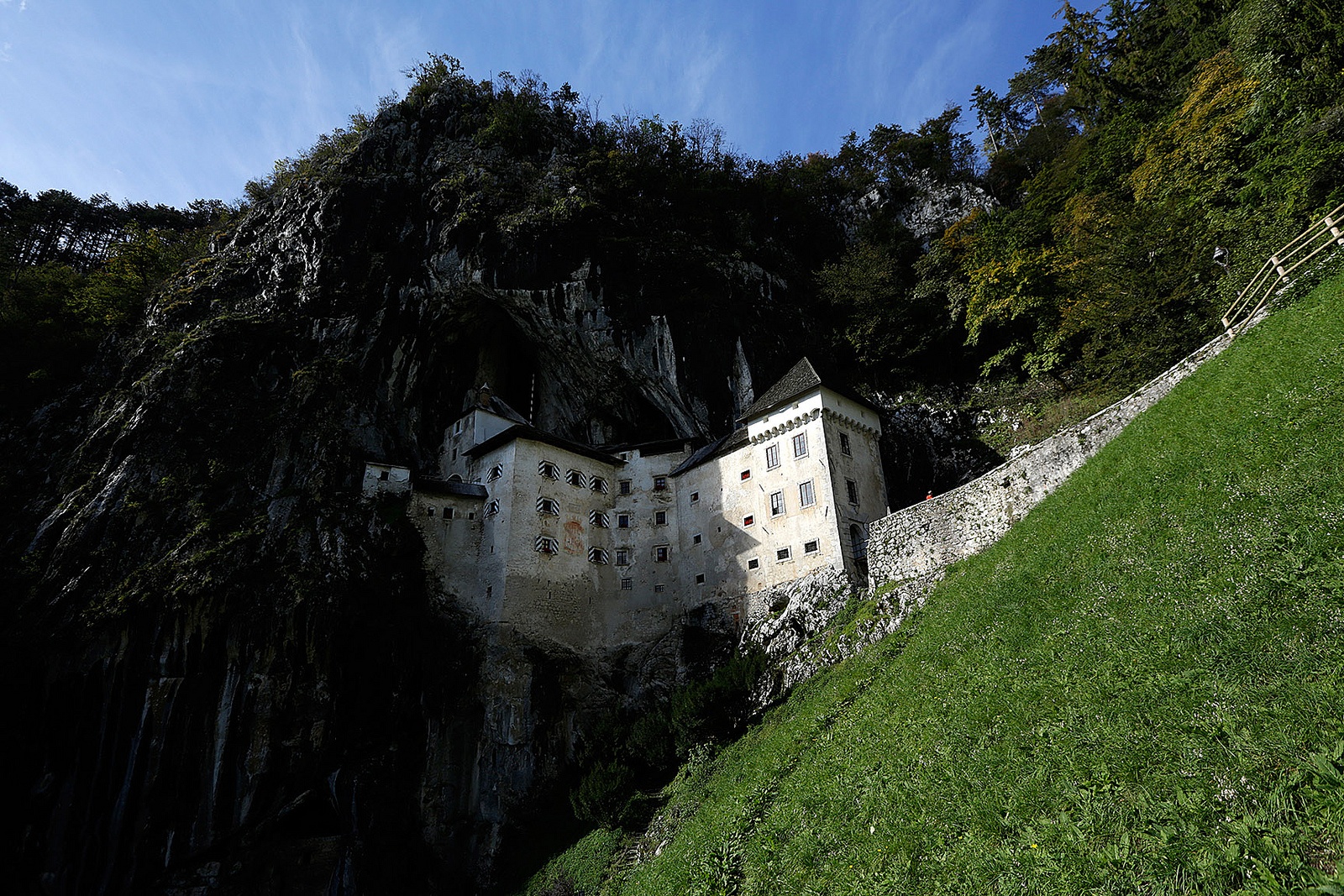
In Predjama, a picturesque village 9 kilometers from the Postojna Cave, the Predjama Castle looms high above the surrounding area.
Kozara National Park – Bosnia and Herzegovina
The Kozara National Park covers an area of 3.907,54 hectares in the heart of Mount Kozara.
Approximately seven kilometers run north-south along the park’s length, and three to six kilometers run wide.
Una National Park – Bosnia and Herzegovina
The First National Park of BiH Federation and the Third National Park of BiH was established in 2008 under the name Una National Park. This park’s primary aim is to preserve the Upper Una’s unique ecosystem and promote ecotourism.
Ogulin – Regional Museum – Croatia
Located in the Lika-Gorski Kotar region, below Klek Mountain, in the town of Ogulin is a picturesque town. Ogulin’s center is made up of King Tomislav’s Park and the Frankopan fortress from the 16th century, which houses the Regional Museum today.
National Park Biogradska Gora – Montenegro
The “Biogradska Gora” National Park occupies most of the Bjelasica mountain range between the rivers Tara and Lim rivers. This area consists of 5400ha and is spread across three localities: Kolašin, Mojkovac, and Berane.
Biogradsko Jezero, Biogradska Rijeka, and the primal forest reservation of Biogradska Gora are some of the most remarkable highlights of the park.
Grebaje valley, Prokletije National Park – Montenegro
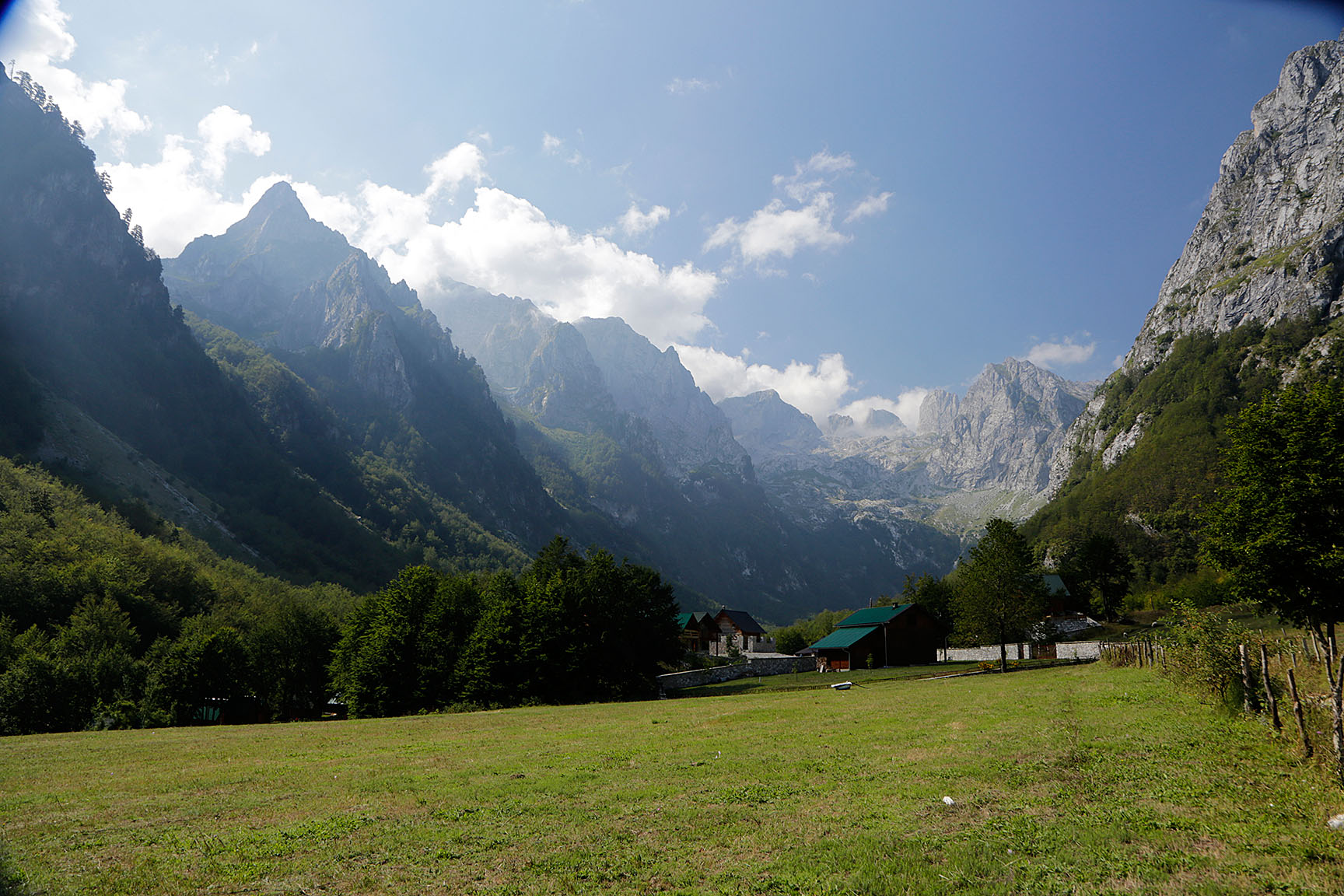
With its contrasts and the sight of surrounding massifs, Grebaje is one of the most attractive valleys. In this valley of warm sun, flowers, and soft breeze, the visitor stands enchanted, gazing at the sky, which is very low because snow-covered rocky peaks overshadow it.
These are areas that are very difficult to reach and even harder to leave.
Valbona Valley National Park – Albania
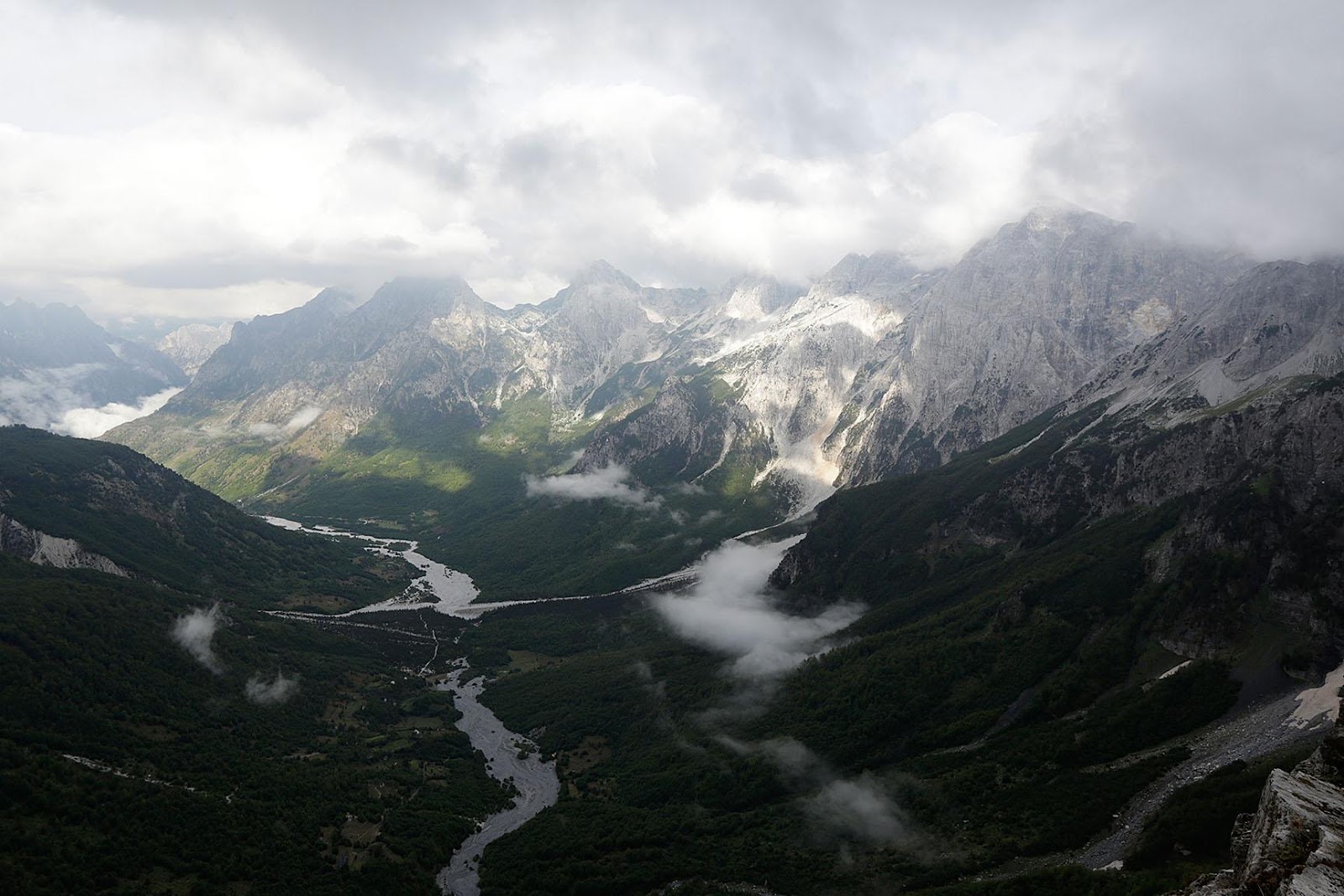
The Valbona Valley National Park is located within the Albanian Alps in northern Albania. The park consists of 80 km2 (31 sq mi), including the Valbona River and its surrounding areas with mountains, glacial springs, deep depressions, rock formations, waterfalls, and the Valbona Valley with its dense coniferous and deciduous forest.
The country’s remote areas have an ecosystem that is largely intact and pristine and has a very remote terrain. There are many pristine plants and animals in this vast ecosystem, which is thought to be the centerpiece of the Albanian Miracle of the Alps.
Similar Trails around the world
GREAT DIVIDE TRAIL
Location: Canada
Distance: 1,200km (746mi)
Duration: 75-90 days
This long, wild trail traverses the Canadian Rockies north to south, stretching nearly 2,000 miles north to south. The trail closely follows the Great Divide, the mountainous hydrological divide that divides North America in two.
TŌKAI NATURE TRAIL
Location: Japan
Distance: 1,697km (1,054mi)
Duration: 40-50 days
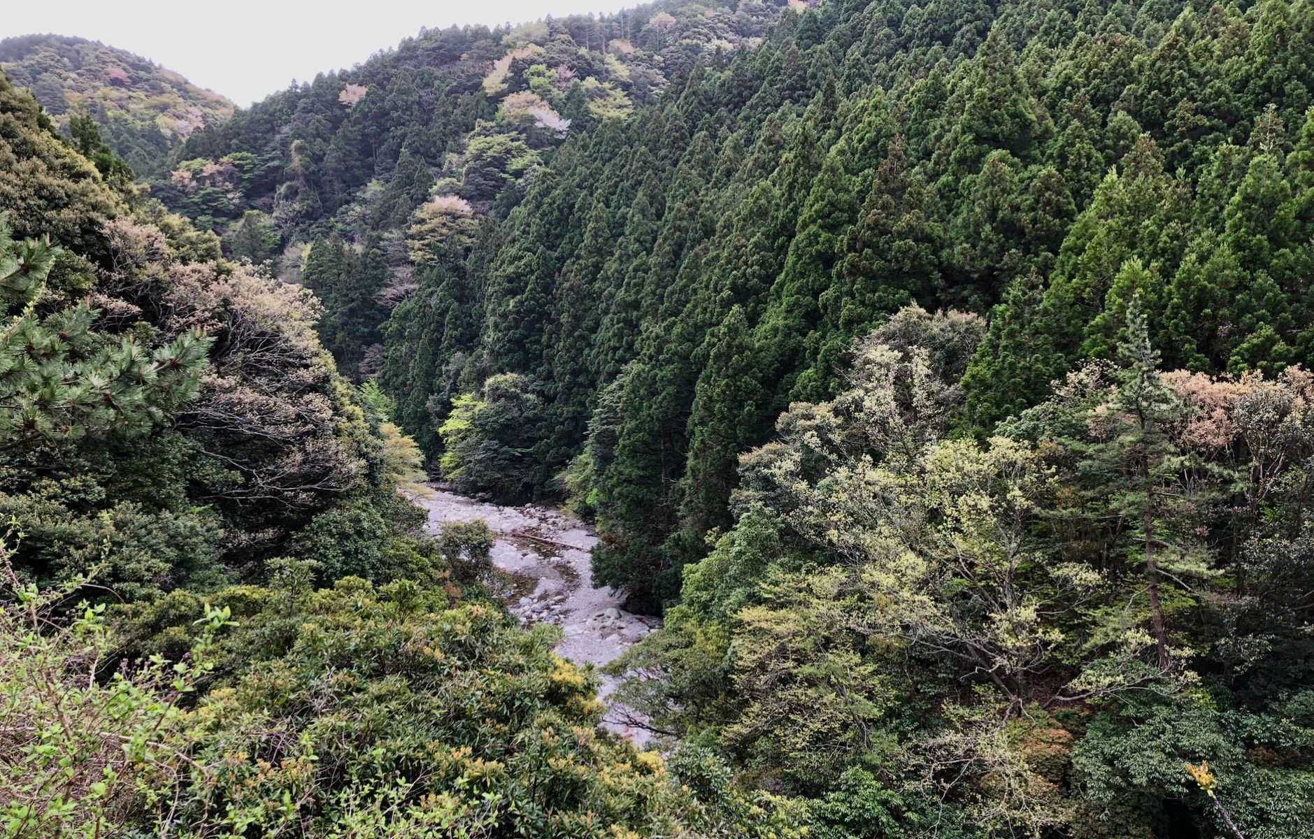
The hiking trail from Tokyo to Osaka traverses 11 prefectures along the way and is one of the gentler, more undulating long-distance hikes on this list. The route passes Japan’s iconic Mount Fuji and plenty of lesser-known cultural and heritage sites and natural beauty.
GREATER PATAGONIAN TRAIL
Location: Argentina, Chile
Distance: 1,500km (932mi)
Duration: 90-110 days
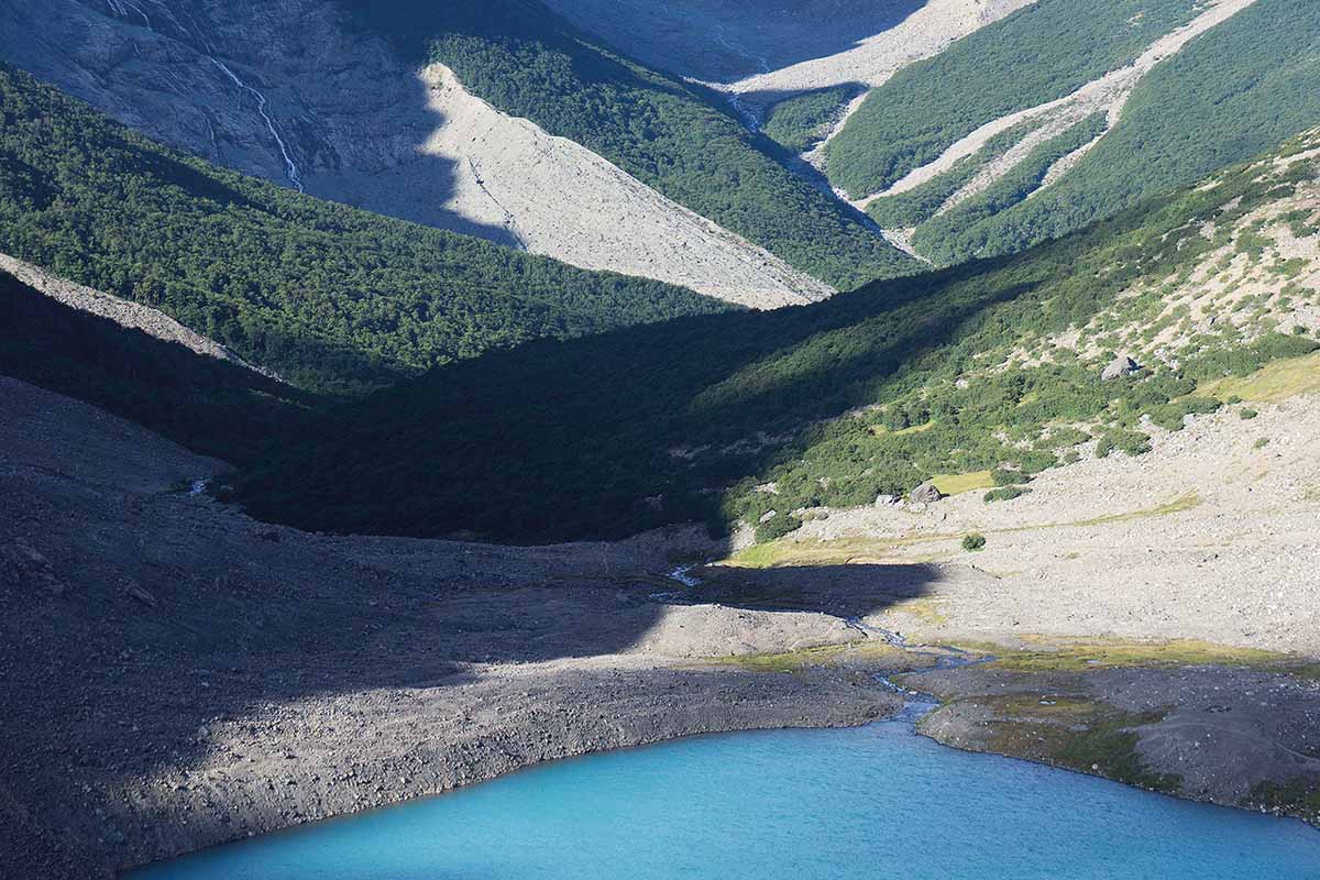
A lot of wild camping is required in this trek across the Patagonian Andes, which is a true survivalist’s trail. Thru-hikers should be challenged to stay fueled and navigate the route since there are few roads on the trail and few towns.
 What To Carry
It’s important to carry a backpack when hiking the Via Dinarica. It should be sturdy, waterproof, and insulate all your goods from bad weather. Clothing, food reserves, a sleeping bag – you will have to have them all on hand.
Make sure your clothes are well suited for both cold and warm weather.
You can choose from a variety of outdoor backpacks designed for this kind of trip. There are also special expedition backpacks that are specifically designed for trips to large mountains.
The Via Dinarica Is More Than Just A Trail
Hiking the Via Dinarica is a journey of a lifetime. It’s an adventure like no other.
If you’re a hiker looking for a hiking trip unlike any other, the Via Dinarica is the trail for you. This hiking trail takes you through some of the most beautiful nature you’ll ever see, but don’t think it’s as simple as going from point A to point B because it’s not!
The Via Dinarica Trail is the first and largest blazed hiking trails in Croatia, Montenegro, Bosnia and Herzegovina, Serbia, Kosovo, Albania, and Macedonia. The trail has a total length of 2700 km.
If you’re looking for more Balkan nature guides:
- 40 + Waterfalls to Visit around the Balkan
- 40+ Balkan Based Historical Sites To Visit
- 9 Balkan Ski Resorts
- https://direktorium.org/29-balkan-mountain-huts/
If you’re not looking for the above, what are you looking for?

Avid travelers, passionate fishermen, and all-around great guys to hang out with (therefore the reason why they are the ones traveling around and not the rest of us, introverts and repulsive individuals). When not writing about their latest trip or catch, they drink beer, play the synth and call their friends to unpurposefully annoy them. A lot.